3D Reality Maps
A german company proposes photorealistic maps in 3d format.


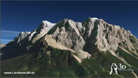
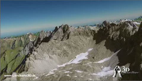
Both of these images look like photographs taken from an airplane but are in fact 3d maps proposed by a german company: 3d Reality Maps.
It proposes maps of large german cities and of the different areas of the Alps. The images above are from the demo video of the latter.
Here is another demo they have posted on Youtube.
Apparently, they use aerial photographs for textures in these maps, but get a level of detail far higher than the ones used on Google Earth or Geoportail (France maps project by the IGN).
You have probably noted that the above video shows trees. The demo for this product also shows rubble around a lake. And above all, the landscapes look highly realistic because the distribution of textures is just right. One can just hope that the next versions of Vue or Terragen could yield such realistic images in the near future.

